This is a 3-part journey that I began on 17 September 2012.
Part 1 – The Ferry Flight
Part 2 – Botswana
Part 3 – Going Home
The intention of this is to share my experiences. The reason I decided to call this my IFR Adventure is because, well, I followed the roads (and sometimes went off the roads and got stuck in sand, whoops). A lot of it is random ramblings, so feel free to skip that and just look at the photos.
My memory isn’t excellent, so please excuse any mistakes (or feel free to point them out). Everything said here is my own opinion.
I will try and update as much as possible, but I’m writing this in bits and pieces.
Cheers!
IFR Adventure, Part 1: The Ferry Flight
For months I had been planning to attend the AAD 2012 air show at AFB Waterkloof. But I also wanted to go to Botswana. As the months ticked by, I tried to figure out how I could go to both the air show and Botswana without spending too much money. Eventually I decided to drive up from the Cape, go to the air show, and then drive to Botswana.
But not even a few weeks before the air show, my plans changed slightly. Our bright yellow aerie, the X285 "Cubby", had been sold and needed to be ferried to her new home: Wonderboom, Pretoria. This was the aircraft I had done my PPL and most of my hour-building on. It taught me how to fly, and gave me a kick in the pants a few times! But I was going to miss it. This ferry flight was to be my last flight in it.
It all worked out well in the end; I still needed a car to get from Pretoria to Botswana, so my Dad drove the car up, and I flew the plane. This way I had a support vehicle. As this was also the first time I’ve done a x-country flight that involves literally flying across the country, it was nice to have a helping hand along the way.
Okay, time for the flying bits... I’m going to try give info on all the places I stopped at.
My route was Stellenbosch – Worcester – Lainsburg – Beaufort West – Gariep Dam – Bloemfontein – Parys – Wonderboom.
DAY 1
FASH – FAWC – Lainsburg – FABW
Departing relatively early in the morning, the weather was nasty and it took me almost an hour just to get to Worcester. Crossing the mountains can be tricky when there’s low cloud, or a lot of wind. My first choice was Bainskloof Pass. Due to cloud covering the mountain-tops, that simply wasn’t an option. So I routed north to Voelvlei Dam (the mountain is lower here), but that also didn’t work. Eventually I tried Franschhoek Pass, and I was able to get over the mountain and remain clear of the cloud. My last option was Sir Lowry’s Pass. With all these crossings, get as much height as you can; the downdraughts can be sudden and violent (especially at Sir Lowry’s Pass).
 ^Weather at Stellenbosch wasn't too lekker.
 ^After crossing the Franschhoek Pass, Theewaterskloof proved to be sunny and clear
I landed at Worcester and filled up with AvGas. This is primarily a gliding airfield, so watch out for tugging and winching operations, especially on weekends. Please read up on the joining and circuit procedures. The runway is long, and part-tar, part-gravel.
 ^Parked at Worcester
From Worcester, I routed through the Hex Rivier Valley. Again, height is your friend when crossing the mountains. Once in the valley, I had smooth flying conditions. At FL075 I was able to get hold of Cape Town Information. Forced landing options are few in this area. There’s an airfield at Touwsrivier and another at Matjiesfontein (I think).
 ^Entering the Hex Rivier Valley
 ^Touwsrivier
My next fuel stop was at Lainsburg. A long gravel strip, there are a few dangers.
The windsock is very difficult to find (I think it was to the south of the runway, about 1/3 down). There are hills to the south east. They use the runway for driving practice, so watch out for the poles/markers they’ve set up. The runway surface is uneven, with a few fist-sized rocks. Once on the ground, don’t leave valuables in your aircraft; the field is right next to a township, and the children will run out as soon as you’ve shut the engine down. Keep an eye on them; they like to touch the “helicopters” and might accidentally break something.
 ^Lainsburg. Can you spot the runway?
 ^Kiddies
 ^Nothing here
There isn’t any fuel here. This was a case where the Support Vehicle supplied the Cubby with juice from a 25l jerry can. In fact, there isn’t much of anything at Lainsburg.
From here, I routed to Beaufort West. I think I was at FL075 again, but I couldn’t get hold of Info. Vis wasn’t great, and as I neared FABW, the mountains loomed out of the haze (which was cool, but a bit unnerving). The airfield is on the ooother side of town, and relatively easy to spot.
 ^Poor vis
 ^Mountains in the haze
Windsock had been ripped to shreds, and I realised why as I flew overhead; the wind rolling off the mountains to the north hit me like a ton of bricks. Watch out for that. Landing rwy 26, I had a lovely 90⁰ x-wind. There was also a lot of wind shear on final approach. Keep your speed up and put it down firmly!
 ^FABW
^FABW
There is a small section with tie-down points near the fuel bay (next to a hangar). Don’t take a chance and leave your aircraft out in the open; that night there were gale force winds and I feared the Cubby might get airborne, even though we did tie it down. Luckily it stayed put.
 ^Tucked in for the night
AvGas and JetA1 are available (but I’d phone beforehand just to make sure). A B&B is conveniently located on the airfield. Good food, good service, nice rooms. There’s also wi-fi available.
The wind picks up quite quickly in the mornings, so plan to leave as early as possible.
That concludes Day 1. Below are some photos of Beaufort West.


*-*-*-*-*-*-*-*-*-*-*-*-*-*-*-*-*-*-*-*-*-*-*-*-*-*-*-*-*-*-*-*-*-*-*-*-*-*-*-*-
DAY 2
FABW – Gariep – New Tempe
On the Beaufort West to Gariep leg, I had less of a tailwind and more of a x-wind and sometimes headwind. I started to become concerned about fuel. There were 3 airfields enroute; Richmond, Hanover and Colesberg.
 ^Near FABW, clearer today
 ^Near Three Sisters, I think. I had a few clouds to keep me company
I can’t remember which one it was, but I really struggled to find the airfield. And instead of wasting time looking for the place, I decided to take a chance and continue. I think I saw the field as I looked back at the town. I remember that Hanover’s runways didn’t look suitable, and I chose to push on to Colesburg. And once there, I decided to just continue to Gariep. I’m always careful with my fuel planning, and base my calculations on a fuel consumption that is actually slightly higher than what it actually uses.
 ^Richmond
 ^Hanover
 ^Colesburg
I made use of every little bit of lift I had, converting the height to speed (whether or not this actually helped I don’t know, but at least it gave me something to do). Vis decreased as I neared Gariep, and I was quite disappointed that I really struggled to make out the area as this is a place I had been wanting to visit for a while.
 ^Haze
^Haze
The runways here are very distinctive and difficult to miss. The windsock was difficult to find (I actually only saw it for the first time as I was taxi-ing to the parking), and it was a case of trial-and-error when it came to landing (was too hazy to see the dam water clearly enough to figure out the wind).
 ^Runways, Gariep
My first landing was bone-jarring, and gave the Cubby’s undercarriage a good workout. I had a stinking great tailwind, so I went around and repositioned for runway 33. There are hills to the right, so watch out for windshear.
Taxi-ing in, the fuel bowser is in the right-most building/shack. Call beforehand if you want fuel, otherwise you might end up waiting a while. You can pay by card, but then you have to go into town, so have cash ready. And don’t forget to pay your landing fees. Oh, I landed with my 45min reserve intact.
 ^Waiting for fuel
From here I set course for Bloemfontein and New Tempe. The weather improved steadily, and about 20nm from Gariep, I heard other traffic for the first time since leaving Stellenbosch. It felt good to know that I wasn’t alone up there!
I think it was somewhere along this leg that I realised I was following the wrong road. Or maybe... it might’ve been when I was leaving Hanover, I started to follow the R389 instead of the N1. Something like that. I DO remember that I realised my mistake within a few minutes, and got back on track. It’s times like those that I just had to laugh at myself, and remind myself to focus.
Anyway. Around Edenburg, I got on the radio to Bloemfontein Approach so that I could get an idea of the weather. I was pleased to hear that it was a nice day there, and for once I wouldn’t have to put up with lots of wind.
 ^Edenburg
Approaching Tierpoort Dam, I heard more traffic, survey aircraft. Everyone changes frequency at a different point; some 15nm from Tempe, or 10nm, or 5nm. As I only had one radio, I broadcast on both the TIBA frequency, and the Tempe frequency, until I got to about 10nm from Tempe, and then I just stuck to their frequency and kept a very good lookout.
 ^Tierpoort Dam in the distance
Seeing Bloemfontein was a very welcome sight; the brown of the Karoo gets VERY boring! While admiring the city, don’t stray too close to Bloemfontein Airport
 ^Bloemfontein
As it’s uncontrolled, flying here is a very simple affair; standard unmanned joining procedures, or just follow the traffic in the circuit. New Tempe has 4 runways, and I used rwy 01. It’s long, but it’s very narrow; watch out for the illusion of being too high.
 ^New Tempe
Fuel and parking are available. The ground staff was very helpful and provided me with a bucket, water and soap to wash all the grime off the Cubby. In fact, everyone there was quite friendly, with a few chopper pilots coming to take a look at the Cubby

There is plenty of accommodation in Bloemfontein. We stayed in the F1 Hotel, which while not cheap, it isn’t as expensive as a lot of the other places. It’s basic, but has all you need, and there is a Spur next door.
The long stretches are not only boring, but dangerous. I found that my mind would start to drift, and I would begin to zone out. I don’t like to listen to music when I fly, because it distracts me too much, so I occupied myself with taking photos of the towns I passed (which were few and far between). I also sang to myself ( not very well I might add). And I ate... Take snacks with; chewing fizzers and mints and nibbling chips helped keep me awake.

*-*-*-*-*-*-*-*-*-*-*-*-*-*-*-*-*-*-*-*-*-*-*-*-*-*-*-*-*-*-*-*-*-*-*-*-*-*-*-*-
Day 3
FATP – Parys – Wonderboom
When you depart New Tempe, be careful of cutting into Bloem’s airspace. I routed to the Krugersdrif Dam, and then headed east to Brandfort. If you route to the dam, you’ll stay clear of controlled airspace.
 ^While doing my run-ups, I heard something considerably bigger behind me, and turned to see a Pawnee
 ^Pawnee overtaking me
Once I was clear of the New Tempe airspace, the other traffic faded away. Routing to Brandfort and then Theunissen, I followed the road/railway track. But from Theunissen, I cut across to a place called Ventersburg in order to avoid Welkom.

^Brandfort

^Erfenis Dam

^Theunissen
It was as I was passing Theunissen that I looked at the world around me and took in the blue skies, the brown earth, and the sheer openness. And I burst into song. “Wide open spaces!” Clearly I lost my marbles somewhere between Brandfort and Theunissen...
 ^Welkom in the distance, I think
From Ventersburg, I followed the road to Kroonstad. There is an airfield just outside of the town. So either get on their frequency and make calls on it, or stay well clear of the field. After Kroonstad I ended up following a wrong road. Again. Instead of following the one that would take me to Vredefort, I found myself routing towards Heilbron (which I’ve wanted to visit, coincidentally, but anyway).
 ^Kroonstad
Once again, I noticed my mistake after a few minutes and got back on track. If you want to go to Vredefort, don’t follow the road with the railway track next to it!
Once overhead Vredefort (about 10nm from FAPY), I changed to the Parys frequency. I don’t know why, but my radio didn’t like it. There was loads of static, I struggled to hear the other traffic, and they struggled to hear me.
A little bit confused, I just kept a good lookout. As I got nearer the field, I still couldn’t see the other traffic. Then I picked up on which runway they were using. Checking my airfield details, I saw that no such runway existed at Parys. Now I started to ask myself if I was at the right place. I had to be, right? Checking my airfield details again once overhead the field, I confirmed that the runways on the piece of paper were the same as those on the ground. So I MUST be at the right place.
I looked around for the other traffic. Nothing. So they were obviously somewhere else.
Parys has a grass and a tar runway. As inviting as the gently sloping grass was, I touched down on the tar (I have a bad history when it comes to the Cubby, grass and punctures).
There is plenty of space to park, and food and drink is available at the clubhouse. The few people I saw while stretching my legs were very friendly. I topped up with petrol here (but I think AvGas is available?).
It’s a really nice little strip, and on my list of “Places to Visit Again”.


Now it was time for the leg I had been dreading. Parys to Wonderboom.
I must admit, I’m one of those pilots who has that stupid fear of air traffic controllers. I hardly ever venture into controlled air space, and now I would have to skirt around some pretty big airports. No pressure, right.
Things were made worse when my aviation GPS refused to acquire the satellites, so I had to rely on my map to make sure I stayed clear of airspace. And if that wasn’t enough, I was thrown off balance when I approached the Carltonville area.
I don’t know why, but I’ve always pictured Gauteng as being almost completely flat. So you can imagine how surprised I was when I saw hills, and mountain-like features. “No, no, no, why isn’t it flat?! This can’t be right! What’s going on?!” I told you I lost my marbles...
Yes... Now, I think I found Carltonville; I’m still not sure what town it was. No matter how hard I tried, I couldn’t find the roads that I was flying over on the map. And you know what they about bad things coming in three’s...
 Carltonville. Maybe?
 Or is THIS Carltonville?
 Magalies Gliding Club (FAOI)
It was all good and well that I familiarised myself with my route, but I didn’t know any of the usual reporting points, GF areas, and land marks. So I had traffic buzzing around, reporting their positions, but I had absolutely no clue of how close they were to me. This was a mistake on my part. Learn the area!
So, keeping a good lookout and broadcasting my position (once I was certain of my location), I puttered on. I passed the Hartebeeshoek Tracking Station, and then I got my first look at the Hartebeespoort Dam. It was quite amazing. From then on, I knew exactly where I was and I could relax a little bit.
 Tracking Station
 Hartbeesport Dam
Having only had my thoughts to keep me company for the last two days, hearing all the other traffic on the radio was a bit overwhelming at first.
Crossing the ridge, I routed to the microwave tower. And then Rosslyn where I switched to Wonderboom Approach.It went something like this...
“Wonderboom approach, Zulu Uniform Delta Victor Romeo, good afternoon!”
“DVR, good afternoon, go ahead.”
“DVR, a Cubby, on a flight from Parys, now overhead the Rosslyn train station, one person on board, no transponder and no flight plan. Request permission to enter the zone for landing”.
“DVR, report overhead the ... dam.”
... The what? Dam, dam, dam, okay, there’s a dam on my map, but there’s no name. Oh no!
“Uhmm... I’m unfamiliar with the area, but there’s a dam in front of me, so I’m just going to fly towards that.” Smooth...
“It’s located between two little koppies, and should be in front of you and to your left.” – I could hear that the controller must have been smiling.
“Ah ok, I’m heading to the correct one then. Thank you! Will call overhead. DVR.”
 The dam in question
Phew! I still didn’t know the dam’s name, so I simply called “Approach, DVR is overhead the dam.”
I’m pretty sure I was instructed to join a left downwind runway 29, and I say this because I remember thinking ‘Why does she want me to fly over the field and join a left downwind, when I’m pretty much on a right downwind?’
So when I read back, she corrected me and said no, I must join on a right downwind. Maybe I made the mistake and heard her incorrectly. Oh well, no harm done.
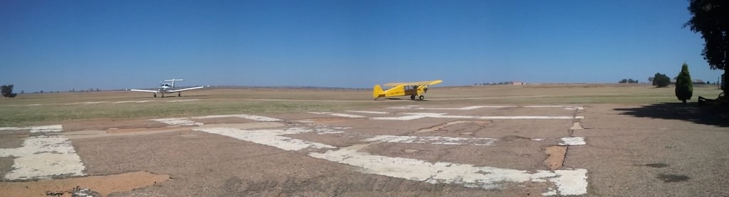
 FAWB
FAWB
There was one aircraft in front of me, and it was doing quite a wide circuit. As I flew further and further away from the runway, I became concerned that I’d end up on a loooooong final. Asking for permission to orbit, I was told to continue on downwind and not to worry because there would be “sufficient spacing”.
I wasn’t concerned about spacing; I was concerned that anything longer than a 2nm final would take a week in the Cubby! But it all worked out okay in the end. I landed safely and vacated, and followed a C172 to the apron (lucky, because I forgot to print a map of the airfield layout).


While I was trying to find the Cubby’s hangar, I taxi’d past all sorts of weird and wonderful machines, and it took some effort to concentrate on staying on the taxi-way. After parking my faithful little aerie, I was relieved because I had survived the busiest airspace I had ever been in. But I was also sad because after almost 200hrs in her, I was saying good bye.

 Apart from the N1, this is what I used to navigate. Standard map and nav log with stop watch. Yellow GPS with points programmed in, to make sure I was going the right way (I'm directionally challenged), and also to get accurate groundspeeds. Garmin 196, which didn't work most of the time, was only used on the Bloem - Parys leg.
Random trip facts
Apart from the N1, this is what I used to navigate. Standard map and nav log with stop watch. Yellow GPS with points programmed in, to make sure I was going the right way (I'm directionally challenged), and also to get accurate groundspeeds. Garmin 196, which didn't work most of the time, was only used on the Bloem - Parys leg.
Random trip facts
Number of Fuel Stops: 6
Total flying time: 13.7hrs
Lowest groundspeed: +- 50kts (luckily only for a few minutes)
Highest groundspeed: +- 90kts (unfortunately also only for a few minutes)
Day 1: 4.5hrs flying
Day 2: 5.1hrs flying
Day 3: 4.1hrs flying
Distance flown: +- 750nm
This trip marked the end of a chapter in my flying. And while the start of the new chapter took a while to get going, the wait has paid off.